File: USA Mississippi Tupelo area NPS map.jpg
No higher resolution available.
USA_Mississippi_Tupelo_area_NPS_map.jpg (285 × 305 pixels, file size: 28 KB, MIME type: image/jpeg)
Summary
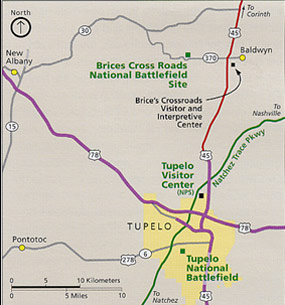
| Description | Area map of Tupelo, Mississippi, showing city limits, roads, and national parks or historic landmarks. Map by US NPS. |
| Date | |
| Source | US National Park Service webpage: http://pagebang.com/cgi/nph-proxy.cgi/111011A/http/www.nps.gov/brcr/planyourvisit/index.htm |
| Author | US Federal Government: Department of the Interior |
| Other versions | (none) |
Licensing
| This image or media file contains material based on a work of a National Park Service employee, created as part of that person's official duties. As a work of the U.S. federal government, such work is in the public domain in the United States. See the NPS website and NPS copyright policy for more information. |
File history
Click on a date/time to view the file as it appeared at that time.
| Date/Time | Thumbnail | Dimensions | User | Comment | |
|---|---|---|---|---|---|
| current | 21:41, 19 July 2007 | | 285 × 305 (28 KB) | wikimediacommons>Wikid77 | {{Information |Description=Area map of Tupelo, Mississippi, showing city limits, roads, and national parks or historic landmarks. Map by US NPS. |Source=US en:National Park Service webpage: http:// |
File usage
The following page uses this file: