File: Map of the Local Government Areas of Lagos.png
Size of this preview: 800 × 421 pixels. Other resolutions: 320 × 169 pixels | 898 × 473 pixels.
Original file (898 × 473 pixels, file size: 105 KB, MIME type: image/png)
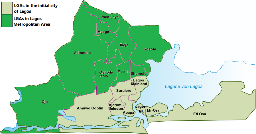
| Description | Map of the Local Government Areas of Lagos | ||||||||
| Date | |||||||||
| Source | Own work | ||||||||
| Author | Bohr | ||||||||
| Permission (Reusing this file) |
I, the copyright holder of this work, hereby publish it under the following licenses:
You may select the license of your choice. This file is licensed under the Creative Commons Attribution-Share Alike 2.5 Generic license.
|
||||||||
| Other versions |
|


File history
Click on a date/time to view the file as it appeared at that time.
| Date/Time | Thumbnail | Dimensions | User | Comment | |
|---|---|---|---|---|---|
| current | 17:25, 20 February 2016 | | 898 × 473 (105 KB) | wikimediacommons>Jamie Tubers | minor correction. differentiating Eti Osa from Lagos Island |
File usage
The following page uses this file: