Christianpedia

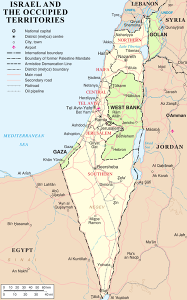
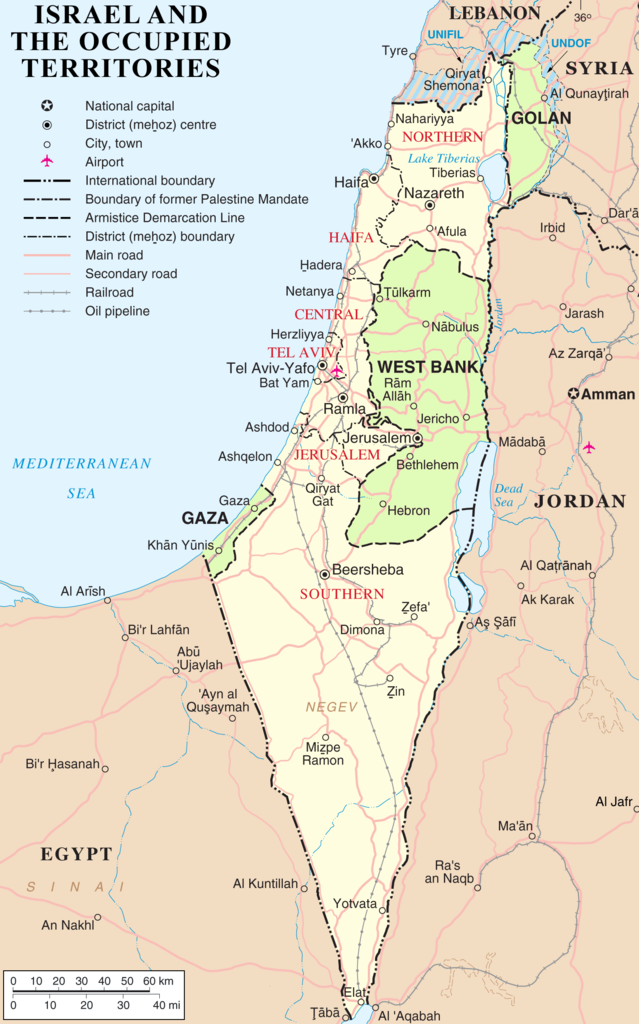
File: Israel and occupied territories map.png

Original file ‎(1,428 × 2,289 pixels, file size: 266 KB, MIME type: image/png)

This file is from Wikimedia Commons and may be used by other projects. The description on its file description page there is shown below.

File:Map of Israel, neighbours and occupied territories-en.svg is a vector version of this file. It should be used in place of this PNG file when not inferior.

File:Israel and occupied territories map.png → File:Map of Israel, neighbours and occupied territories-en.svg

For more information, see Help:SVG.

In other languages
Alemannisch ∙ العربية ∙ беларуская (тарашкевіца) ∙ български ∙ বাংলা ∙ català ∙ нохчийн ∙ čeština ∙ dansk ∙ Deutsch ∙ Ελληνικά ∙ English ∙ British English ∙ Esperanto ∙ español ∙ eesti ∙ euskara ∙ فارسی ∙ suomi ∙ français ∙ Frysk ∙ galego ∙ Alemannisch ∙ עברית ∙ हिन्दी ∙ hrvatski ∙ magyar ∙ հայերեն ∙ Bahasa Indonesia ∙ Ido ∙ italiano ∙ 日本語 ∙ ქართული ∙ 한국어 ∙ lietuvių ∙ македонски ∙ മലയാളം ∙ Bahasa Melayu ∙ မြန်မာဘာသာ ∙ norsk bokmål ∙ Plattdüütsch ∙ Nederlands ∙ norsk nynorsk ∙ norsk ∙ occitan ∙ polski ∙ prūsiskan ∙ português ∙ português do Brasil ∙ română ∙ русский ∙ sicilianu ∙ Scots ∙ slovenčina ∙ slovenščina ∙ српски / srpski ∙ svenska ∙ தமிழ் ∙ ไทย ∙ Türkçe ∙ татарча / tatarça ∙ українська ∙ vèneto ∙ Tiếng Việt ∙ 中文 ∙ 中文(中国大陆) ∙ 中文(简体) ∙ 中文(繁體) ∙ 中文(马来西亚) ∙ 中文(新加坡) ∙ 中文(臺灣) ∙ +/−
New SVG image

Summary

Description
English: Map of Israel, the Palestinian territories (West Bank and Gaza Strip), the Golan Heights, and portions of neighbouring countries. Also former United Nations deployment areas in countries adjoining Israel or Israeli-held territory, as of February 2018.
Date
Source http://www.un.org/Depts/Cartographic/map/profile/israel.pdf (heavily modified)
Author ChrisO
Permission
(Reusing this file)
Public domain This image is a map derived from a United Nations map.

Unless stated otherwise, UN maps are to be considered in the public domain. This applies worldwide.
Some UN maps have special copyrights, as indicated on the map itself.

UN maps are, in principle, open source material and you can use them in your work or for making your own map. UN requests however that you delete the UN name, logo and reference number upon any modification to the map. Content of your map will be your responsibility. You can state in your publication, if you wish, something like: based on UN map … (map name, map number, revision number and date). See: Geospatial Information Section. And: Geospatial, location data for a better world.

Public domain I, the copyright holder of this work, release this work into the public domain. This applies worldwide.
In some countries this may not be legally possible; if so:
I grant anyone the right to use this work for any purpose, without any conditions, unless such conditions are required by law.
Other versions

Captions

Add a one-line explanation of what this file represents

Items portrayed in this file

depicts

27 March 2007

271,953 byte

2,289 pixel

1,428 pixel

image/png

9c47cc51164f850d8cc8a72740fefb887a734d18

File history

Click on a date/time to view the file as it appeared at that time.

Date/TimeThumbnailDimensionsUserComment
current03:50, 14 May 2018Thumbnail for version as of 03:50, 14 May 20181,428 × 2,289 (266 KB)wikimediacommons>NableezyReverted to version as of 23:21, 5 March 2018 (UTC) restore, your changes are incorrect, make a new title if you want

The following page uses this file:

Metadata

Discuss this page