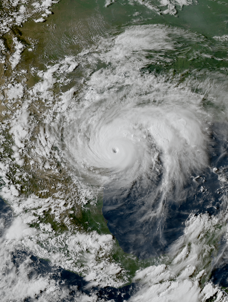
File: Harvey 2017-08-25 2231Z.png

Size of this preview: 452 × 599 pixels. Other resolutions: 181 × 240 pixels | 362 × 480 pixels | 579 × 768 pixels | 773 × 1,024 pixels | 1,546 × 2,048 pixels | 4,000 × 5,300 pixels.



Original file (4,000 × 5,300 pixels, file size: 32.54 MB, MIME type: image/png)

Summary
| Description |
English: Hurricane Harvey near the coast of Texas at peak intensity late on August 25, 2017. |
| Date | |
| Source | RAMMB/CIRA SLIDER |
| Author | ABI image captured by NOAA’s GOES-16 satellite |
| Camera location |  | View this and other nearby images on: OpenStreetMap |  |
|---|

Licensing

|
This image is in the public domain because it contains materials that originally came from the U.S. National Oceanic and Atmospheric Administration, taken or made as part of an employee's official duties.
|
 |
File history
Click on a date/time to view the file as it appeared at that time.
| Date/Time | Thumbnail | Dimensions | User | Comment | |
|---|---|---|---|---|---|
| current | 12:08, 23 August 2024 | | 4,000 × 5,300 (32.54 MB) | wikimediacommons>Supportstorm | Reverted to version as of 01:18, 15 May 2021 (UTC) Unexplained revision to a lower resolution version |
File usage
There are no pages that use this file.
