Christianpedia

File: Argentina topo blank.jpg
Original file(1,600 × 2,153 pixels, file size: 565 KB, MIME type: image/jpeg)

This file is from Wikimedia Commons and may be used by other projects. The description on its file description page there is shown below.

Description
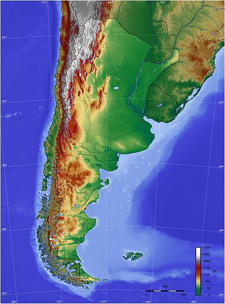
Español: Mapa de Argentina con su relieve
English: Map of Argentina with its terrain levels
Date 9/06/2006
Source See below
Author Captain Blood
Permission
(Reusing this file)

বাংলা  English  español  français  italiano  日本語  македонски  sicilianu  中文(简体)  中文(繁體)  +/−

GNU head Permission is granted to copy, distribute and/or modify this document under the terms of the GNU Free Documentation License, Version 1.2 or any later version published by the Free Software Foundation; with no Invariant Sections, no Front-Cover Texts, and no Back-Cover Texts. A copy of the license is included in the section entitled GNU Free Documentation License.
w:en:Creative Commons
attribution share alike
This file is licensed under the Creative Commons Attribution-Share Alike 3.0 Unported license.
You are free:
  • to share – to copy, distribute and transmit the work
  • to remix – to adapt the work
Under the following conditions:
  • attribution – You must give appropriate credit, provide a link to the license, and indicate if changes were made. You may do so in any reasonable manner, but not in any way that suggests the licensor endorses you or your use.
  • share alike – If you remix, transform, or build upon the material, you must distribute your contributions under the same or compatible license as the original.
This licensing tag was added to this file as part of the GFDL licensing update.


Captions

Add a one-line explanation of what this file represents

Items portrayed in this file

depicts

image/jpeg

4800174322b45657ff9baa146988d48f7b15aeba

578,587 byte

2,153 pixel

1,600 pixel

File history

Click on a date/time to view the file as it appeared at that time.

Date/TimeThumbnailDimensionsUserComment
current21:45, 13 May 2009Thumbnail for version as of 21:45, 13 May 20091,600 × 2,153 (565 KB)wikimediacommons>Keysangerreverted. (Deleted yellow line in the Straits of Magellan, added the definitive end of the controversial border at the Beagle Channel and marked with a white box the (last) undefined border zone as agreed both countries.)

The following page uses this file:

Metadata

Discuss this page