Christianpedia

Template:Partition Plan-Armistice Lines comparison map legend
Revision as of 04:08, 23 May 2024 by Hutah (talk | contribs) (New)
(diff) ← Older revision | Latest revision (diff) | Newer revision → (diff)
Captions for this image

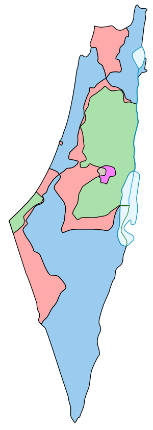
Boundaries defined in the 1947 UN Partition Plan for Palestine:

  Area assigned for a Jewish state
    Area assigned for an Arab state
    Planned Corpus separatum with the intention that Jerusalem would be neither Jewish nor Arab

Armistice Demarcation Lines of 1949 (Green Line):

      Israeli controlled territory from 1949
    Egyptian and Jordanian controlled territory from 1948 until 1967
Discuss this page