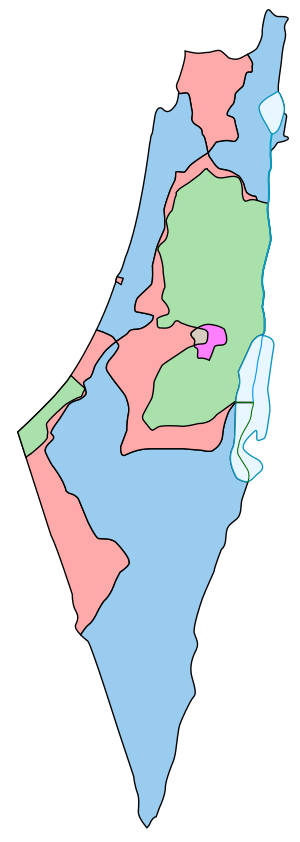
Template: Partition Plan-Armistice Lines comparison map legend
| [unchecked revision] | [unchecked revision] |
m (New) |
m (1 revision imported: New) |
(No difference)
| |
Latest revision as of 04:35, 1 June 2024

Boundaries defined in the 1947 UN Partition Plan for Palestine:
Area assigned for a Jewish state
Area assigned for an Arab state
Armistice Demarcation Lines of 1949 (Green Line):
Israeli controlled territory from 1949